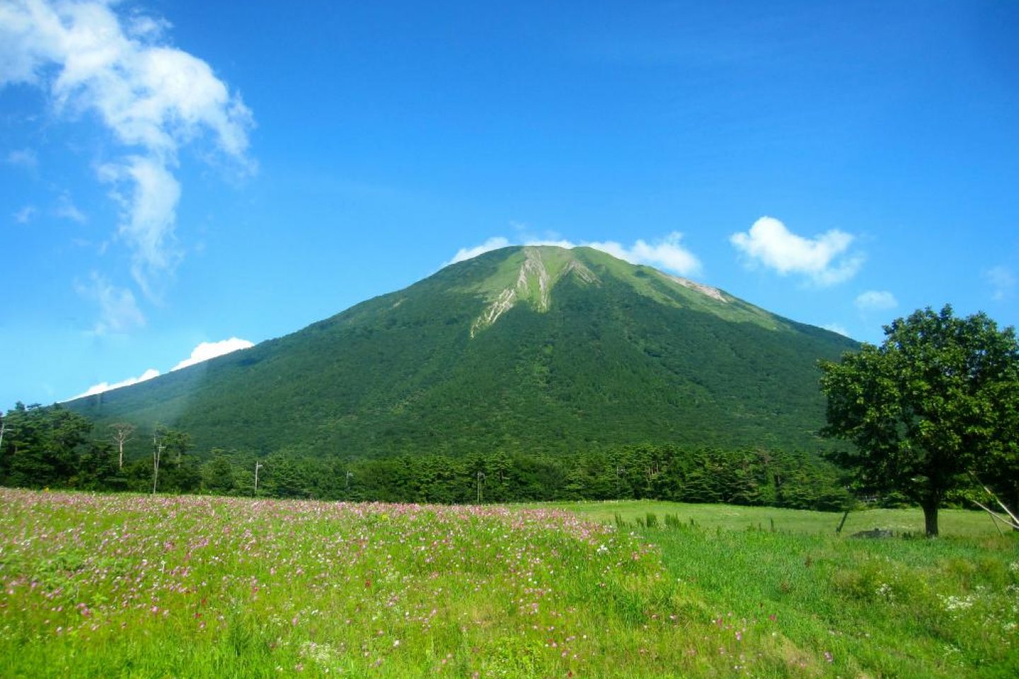

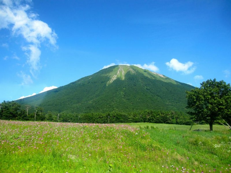
While traveling through Tottori and Shimane Prefectures I had the opportunity to climb Mt. Daisen, a volcano that is so perfectly symmetrical from some angles that it is known as, "the Fuji of the West," and at 1729m (that's 5671 feet to everyone who uses imperial), it's also the highest mountain in West Japan, and you view all 5671 feet of Daisen from sea level. Mt. Daisen maybe less than half the height of Mt. Fuji but it’s just as steep. The climb is punishing to one's entire body, particularly one's knees, but it is a "must do" experience if you are in Tottori. Gorgeous wild flowers, pristine forests and views all the way to the Oki Islands, almost 60 miles out into the Sea of Japan, await you from anywhere the trees don't obstruct your view.
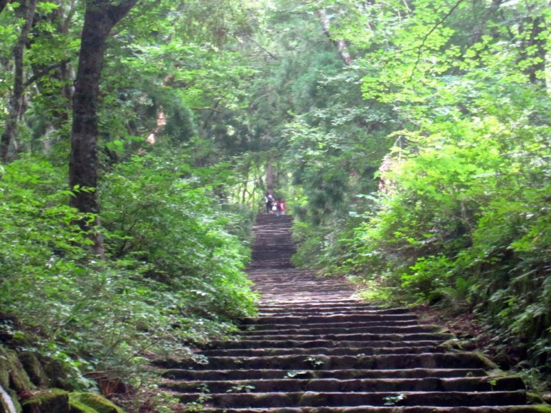
Mt. Daisen is a ~30-minute bus ride from Yonago Station. A 1-day Open Ticket for the Daisen Loop is ¥1100 (cheaper than the regular round trip fare). Get it from the bus terminal just to the west of Yonago Station. The bus departs from a well marked platform in front of Yonago station every 2 hours, 20 minutes after the hour (first bus is at 7:20 am). Ride the bus to Daisenji, the last stop. It drops you off at the Mt. Daisen Information Office where you can check on the climbing routes, conditions, collect pamphlets, and maps. English speaking staff are on hand and all of the brochures and maps are available in English. To get to the Mt. Daisen trail from here, walk up to the main road and follow it up the hill until it flattens out. There are 2 omiyage stores on opposite corners to your right. Turn right down this street and walk until you cross the bridge over the small river. You will pass a Mont Bell store on the left and enter a parking lot with a bathroom. This is the last bathroom until you get to the 1400m on the mountain. Walk to the top of the parking lot and start climbing. The climb will be very steep and full of tall stairs all the way until the 1600m mark. Pace yourself. Drink lots of water. Take as many breaks as you need, and pack a sweat towel.
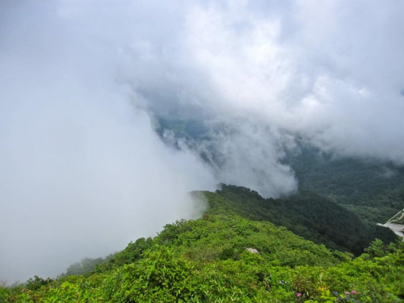
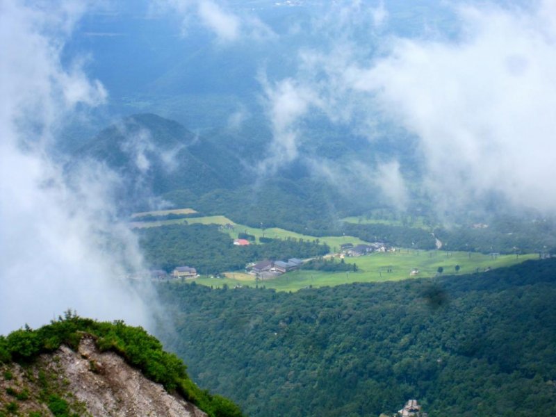
As you ascend higher onto the mountain, the forest changes from tall mixed pine and deciduous trees, to shorter scrub oak and other small vegetation that is about head height, giving way at last to open mountain meadows with fields of blue, pink, red, purple and orange wildflowers. The great "wall" of Daisen and it's sub-peaks (Mt. Daisen suffered a Mt. St. Helens-esque eruption several thousand years ago that blew out its north east flank) appears multiple times through the trees, as do views of Yonago, the Sea of Japan, and the gracefully curving Yumigahama Coastline.
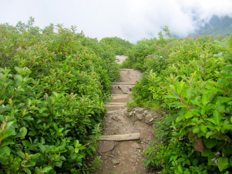
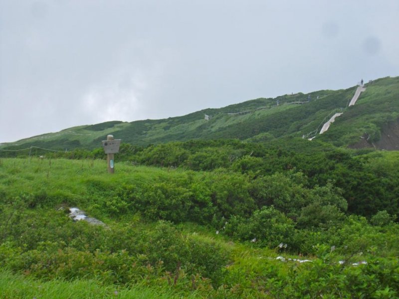
Once you get to 1400m, the 6th Station (you encounter signs that have a number and the kanji 合目[gomé] every 100m of vertical elevation gain), you reach a large rest area that has bathrooms and a good view of the surrounding area. This is your last chance to use a bathroom before the summit. At 1600m you will reach the rim of the volcanic crater and the steepness of the climb is drastically reduced. The final 100 vertical meter climb to the summit is barely inclined compared to the rest of the ascent. The trail also transfers to an elevated wooden boardwalk making the last bit of going really easy. The Mt. Misen Summit (1710m or 5609ft), the official high point of the climb, is just 10-15 minutes walk from the start of the boardwalk. Refreshing breezes, wildflowers and excellent views reward the determined climber.
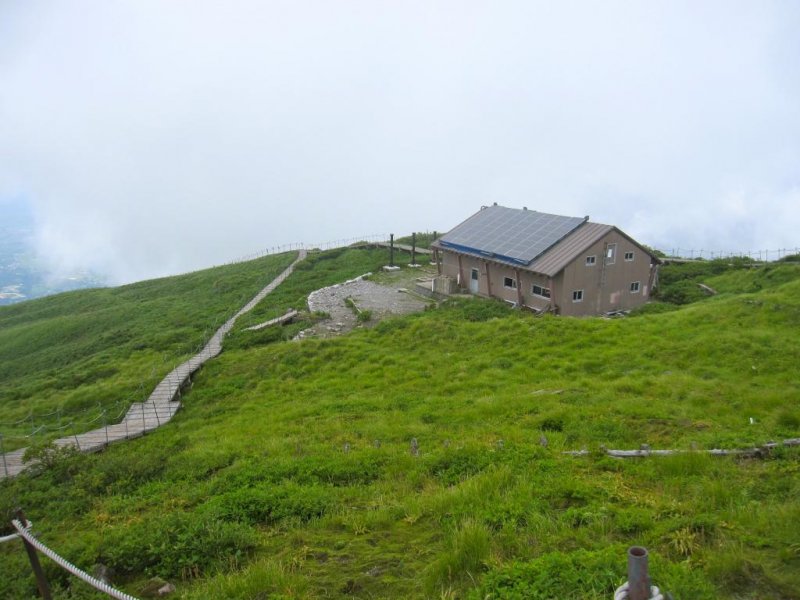
At the Mt. Misen Summit there is a small mountain hut with a sleeping loft (no charge to anyone who wants to stay, but nothing in the way of cooking facilities or running water). An amphitheater topped by a summit marker marks the end of the route. Climbing past Mt. Misen to the true summit, of Kengamine (the Japanese word for the highest point on a mountain with multiple peaks), while not illegal (the signs say it's dangerous please don't climb past this point), is strongly discouraged by the National Park Service owing to a short section of narrow loose rocks. If I hadn't consumed all my water I would have pushed onto the summit. Anyone wishing to do so is advised that help will be very slow and difficult to mobilize if you fall. Continue at your own risk.
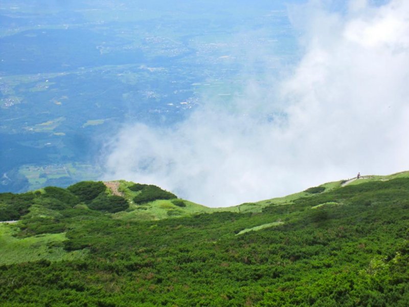
Descend Daisen by the way you came. You can also descend via the Motodani trail which meets the Mt. Daisen trail at about 1200m. The Motodani Trail will take you into the bottom of the volcanic crater and put you out at the Daisen Temple. It's a very pretty hike but its very steep until you get near the bottom of the valley. The highlight is being surrounded by the entire wall of Mt. Daisen. Safe climbing!


")


")


![[2013夏‧東北四祭] 奥入瀨溪流小健行](https://a0.cdn.japantravel.com/photo/6529-44940/90x60!/青森-2013夏-東北四祭-奥入瀨溪流小健行-44940.jpg "[2013夏‧東北四祭] 奥入瀨溪流小健行")